More Soggy Weather – Could Be NJ’s Wettest Halloween in 60+ Years
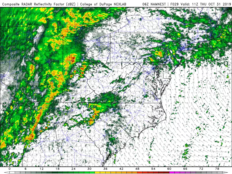
There is absolutely no hyperbole in that headline. Forecast models are now pumping out a solid inch-plus of rain for northern and central New Jersey on Thursday, with somewhat drier totals along the coast. For several weather stations, that would indeed represent the wettest October 31st since 1956 — 63 years ago.
Having said that, I'm still confident that we're going to see a break in the rain late Thursday afternoon into Thursday evening. The timing could be just perfect for trick-or-treating or other spooky holiday activities. However, it's not going to be pleasant exactly, as a howling wind will start to kick up at that time too.
For Wednesday, we're looking at generally cloudy and damp conditions once again. Although a wind shift is expected, from northeasterly to southerly. That will eventually shut off the drizzle machine. Still, we're facing sprinkles and showers at any time Wednesday, and I doubt you'll see much (if any) sunshine. (A few model runs have painted limited blue sky over South Jersey Wednesday late afternoon.)
Temperatures will finish the day in the lower to (maybe) mid 60s. (I've lowered my temperature forecast here — just how warm it gets depends entirely on the timing of that wind shift.)
Any risk for steadier rain will hold off until Wednesday night, after 8 p.m. at the earliest. And then it's pretty much going to pour overnight.
According to the latest forecast models — which have shown pretty good consistency over the past few runs — Thursday's wet weather will play out in three stage:
1.) A round of scattered light to moderate rain through Thursday morning and Thursday early afternoon.
2.) Pockets of dry weather between about 5 p.m. and 11 p.m. — there's your potentially perfect timing for trick-or-treating.
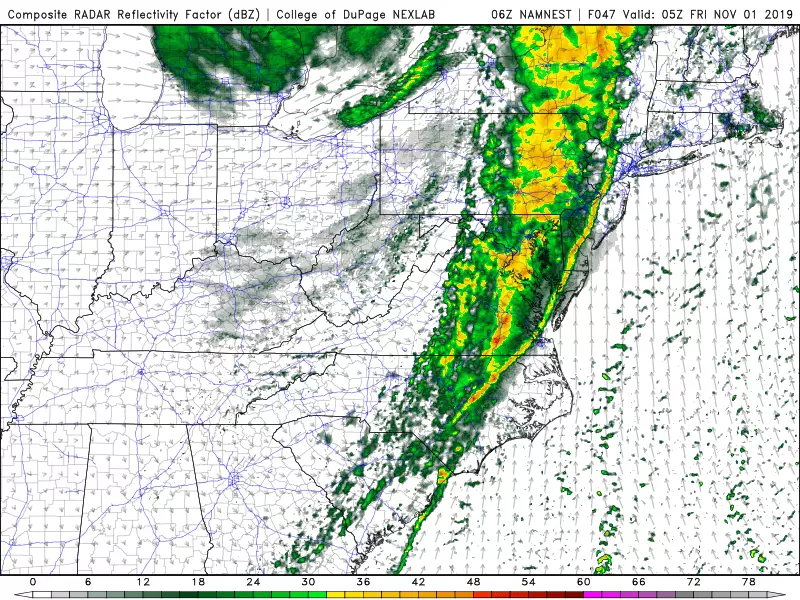
3.) One final burst of heavy rain and thunderstorms, associated with an approaching cold front, will move in late Thursday night (Midnight-ish) into early Friday morning.
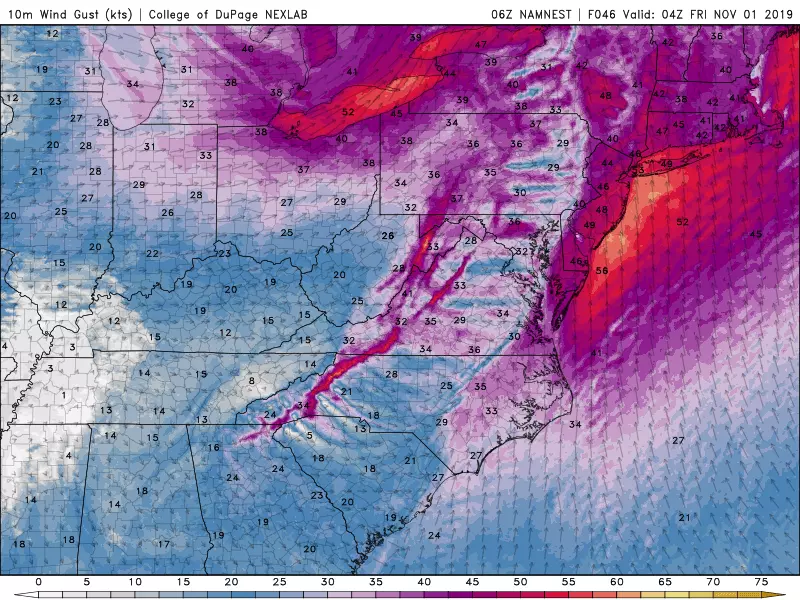
In addition to dodging raindrops, you'll also have to contend with a bit of wind for Halloween. Most of the day will be breezy — but at least that southerly wind will carry in some warm and humid air, pushing temperatures to around 70 degrees. I am becoming increasingly concerned that the latest guidance pushes gusts to about 40 mph starting around dinnertime Thursday. That's certainly going to make for a blustery evening. And such gusts would also be strong enough to blow around tree branches (and costume accessories). I still believe the strongest wind of the day will hold off until late at night (with the frontal passage).
Once the cold front passes Thursday night, you'll know it immediately. Fierce wind gusts to 50 mph are possible, blowing out of the west-northwest. Rain will rapidly come to an end. And both temperatures and dew points will drop dramatically through Friday morning. (From temp 70 / dewpt 65 to temp 45 / dewpt 35 in a matter of hours.)
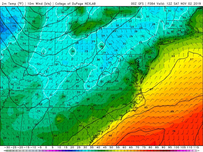
The sun will shine brightly on Friday. But we kick off the month of November with a cool, blustery day. Afternoon temperatures will only reach the lower to mid 50s — more reminiscent of a nice Thanksgiving Day. Winds will be sustained at 10 to 20 mph, with occasional gusts to 30 mph throughout the day.
The weekend will be sunny and dry, but still cool. For Saturday, we could see widespread 30s in the morning followed by mid 50s in the afternoon. Sunday's air mass looks slightly cooler, so I'll keep high temps only in the lower 50s. Again, that is almost 10 degrees below normal for this time of year.
It looks like our weather will stay relatively quiet and cool through the first half of November. A few passing storm systems, with temperatures at or just below normal. I do not see any substantial threat of snow in the forecast... yet.
More From Rock 104.1