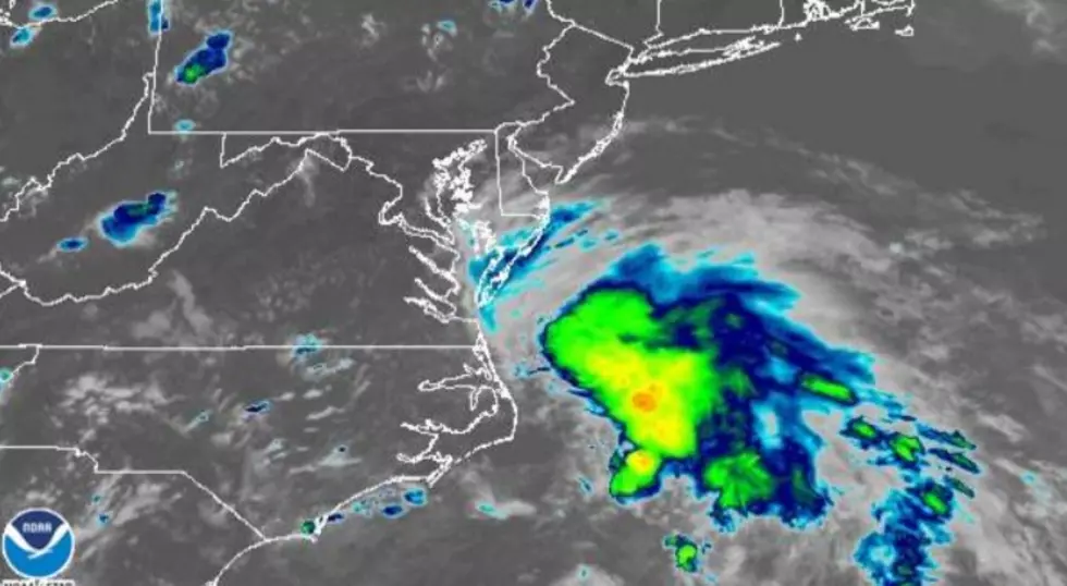
T.S. Fay Forms off North Carolina; Tropical Storm Warning for South Jersey
As of 5:00 Thursday evening, the National Hurricane Center says Tropical Story Fay has formed just off of the coast of North Carolina.
The center of Fay, as of 5PM Thursday, was centered about 40 miles ENE of Cape Hatteras, NC, moving north at 7 MPH. Fay has maximum sustained winds of 45 MPH.
A Tropical Storm Warning has been issued from Cape May, NJ, northward to Watch Hill, RI, meaning that tropical storm conditions are expected in that area soon. For our area, that would during the day Friday.
Forecasters say Fay will continue to move in a general north to north-northeast direction and slowly pick-up speed.
Chief Meteorologist Dan Zarrow says,
The upgrade in the storm's status and the warnings do not change our forecast at all. New Jersey's weather will go downhill late Thursday night, with first raindrops arriving in South Jersey around Midnight and heavy rain bands by sunrise Friday morning. The worst conditions will come during the daytime hours Friday. The center (eye) of the storm may make landfall along NJ's southern coast in the early afternoon. Conditions will gradually improve from south to north, from Friday afternoon to evening.
Our biggest concern from Fay will be bands of very heavy rain, leading to potential flash and river flooding. Top rainfall totals in New Jersey will probably exceed 3+ inches. Top wind gusts (along the coast) will probably exceed 40+ mph. Less than a foot of storm surge will cause minor coastal flooding at high tide. A high risk of rip currents is already posted for tomorrow.


